 National Rehab Helpline
Key Numbers
- Listed treatment facilities
- 472closed listings excluded
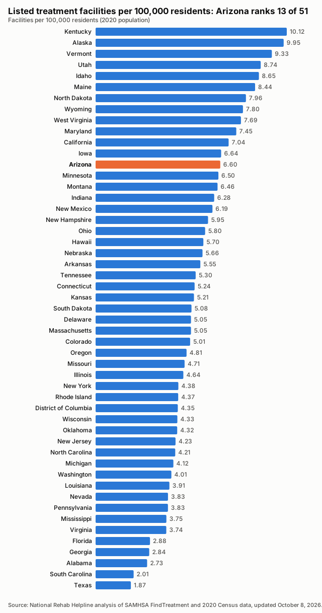
- Facilities per 100,000 residents
- 6.602020 Census population
- Treatment deserts
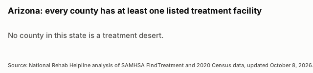
- 0of 15 counties have no listed facility
- Residents of treatment deserts
- 0people in zero-facility counties
- Accept Medicaid
- 87.3%412 of 472 listed facilities
- Population
- 7,151,5022020 Census
Last updated , when the source report was generated.
These figures count listed facilities, not capacity or quality: a listing does not show how many people a facility can treat, how soon, or how well.
How the State Compares
Treatment Deserts
Every county in this state has at least one listed treatment facility.
Desert Counties by Population
All Counties, Ranked
| Rank | County | Population | Listed facilities | Per 100,000 | Status |
|---|---|---|---|---|---|
| 1 | Greenlee County | 9,563 | 2 | 20.91 | |
| 2 | Graham County | 38,533 | 6 | 15.57 | |
| 3 | Navajo County | 106,717 | 16 | 14.99 | |
| 4 | Cochise County | 125,447 | 18 | 14.35 | |
| 5 | Yavapai County | 236,209 | 27 | 11.43 | |
| 6 | Santa Cruz County | 47,669 | 5 | 10.49 | |
| 7 | Yuma County | 203,881 | 20 | 9.81 | |
| 8 | Gila County | 53,272 | 5 | 9.39 | |
| 9 | Mohave County | 213,267 | 18 | 8.44 | |
| 10 | Pima County | 1,043,433 | 84 | 8.05 | |
| 11 | Pinal County | 425,264 | 27 | 6.35 | |
| 12 | Apache County | 66,021 | 4 | 6.06 | |
| 13 | La Paz County | 16,557 | 1 | 6.04 | |
| 14 | Maricopa County | 4,420,568 | 233 | 5.27 | |
| 15 | Coconino County | 145,101 | 6 | 4.14 |
Methodology
Every number on this page is calculated directly from public records; no figure is estimated or written by hand.
Facilities are the treatment locations listed in SAMHSA's FindTreatment.gov locator, each counted once by its listing ID. Closed listings are excluded; active and unconfirmed listings are included (unique IDs; closed excluded; active and unconfirmed included).
Density divides the number of listed facilities by the 2020 Census resident population and multiplies by 100,000.
A treatment desert is a county with zero listed facilities. Facilities are placed in counties by their coordinates against Census county boundaries; deserts are only reported when every listed facility in the state has a verified county.
The Medicaid share is the number of listed facilities that report accepting Medicaid divided by all listed facilities; facilities that do not report it count as not confirmed.
Distances are straight-line (great-circle) miles from a county's Census reference point to the nearest geocoded listed facility in any state. They are not driving distances.
These are listed facilities, not capacity or quality: counts describe listings, not beds, wait times, outcomes or proof of access to care.
Known Gaps in This Data
- None reported for this state.
Sources and Reuse
- SAMHSA FindTreatment.gov treatment locator (Substance Abuse and Mental Health Services Administration): Listed treatment facilities, operating status and Medicaid acceptance.
- 2020 Census redistricting data (P.L. 94-171), table P1 (U.S. Census Bureau): State and county resident population (2020).
- 2020 cartographic boundary files, counties (1:500,000) (U.S. Census Bureau): County boundaries for assigning facilities to counties and for the county map.
- 2020 Census Gazetteer files, counties (U.S. Census Bureau): County reference points for nearest-facility distances.
Download this data: County table (CSV) · Full data (JSON)
Licence: this data and its charts are published under the Creative Commons Attribution 4.0 (CC BY 4.0) licence. You may copy, share and adapt them, including commercially. Attribution: credit National Rehab Helpline and link to the source page, https://nationalrehabhelpline.com/data/arizona/.